Malem Hodar Department (Malem Hoddar)
Malem Hodar Department is one of the 45 departments of Senegal, and is located in the Kaffrine Region. It was created as part of the new region in 2008.
The main settlement is the commune of Malem Hodar. Id addition there are the rural communities (Communautés rurales) of Darou Minam, Djanke Souf, Khelcom, Ndiobene Samba Lamo, Ndioume Ngainthe and Sagna.
The main settlement is the commune of Malem Hodar. Id addition there are the rural communities (Communautés rurales) of Darou Minam, Djanke Souf, Khelcom, Ndiobene Samba Lamo, Ndioume Ngainthe and Sagna.
Map - Malem Hodar Department (Malem Hoddar)
Map


Country - Senegal
 |
 |
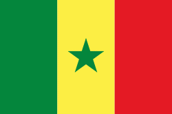
| Flag of Senegal | |
Senegal is notably the westernmost country in the mainland of the Old World, or Afro-Eurasia. It owes its name to the Senegal River, which borders it to the east and north. The climate is typically Sahelian, though there is a rainy season. Senegal covers a land area of almost 197000 km2 and has a population of around million. The state is a unitary presidential republic; since the country's foundation in 1960, it has been recognized as one of the most stable countries on the African continent.
Currency / Language
| ISO | Currency | Symbol | Significant figures |
|---|---|---|---|
| XOF | West African CFA franc | Fr | 0 |
| ISO | Language |
|---|---|
| FR | French language |
| WO | Wolof language |